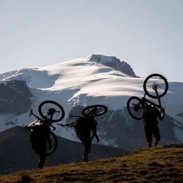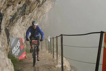
The Tour du Mont Blanc can be ridden as a bikepacking trip crossing between France, Italy and Switzerland
The Tour of Mont Blanc is an 11 day trek around Mont Blanc. I didn’t have 11 days, I wanted to keep a lunch appointment with a friend in 3 days time, but I did have a bike and just enough ignorance to think I could do it.
Despite my carefully preparations things didn’t start well. I had forgotten to replace the retaining pin in my new brake pads and lost a valuable 30 minutes searching the car park. Boy, I was glad Paul Errington wasn’t around to see this. I then started unpacking, I had too much stuff, there is always too much stuff, too much indecision and apprehension. Alpine start lost.
Time waster, amateur, I was lost before I had already started. It was time I just got on with it, no more thoughts. I locked the van and buried my doubts.

Another weighty decision was to carry my d-SLR. I figured it was unlikely that I would be doing this many times and wanted to get some great shots, but after the first few snaps the batteries were on red. Oh great, suddenly I was facing 1kg of dead weight to make my life more difficult than it already was. Not so smart, maybe I should sign up for some tips from MTB photographer Benji Haworth.
From Les Contamines the long 1000 metre climb to the Col du Bonhomme started to kick in. I was optimistic at riding a good part of this, but was soon disappointed. I pretty much pushed it all. A guided group came past, sturdy looking fellas standing up on their granny rings. They rode past me and at La Balme I was all ready to bail, the push/ride ratio was in serious negative figures.
Option 1: Quit, bivvy and return to Chamonix tomorrow. Option 2 : Commit don’t quit, keep pushing, explore the unknown, go beyond the point of no return. I was stressing about making it in 2 days, but what was wrong with 3, or even 4 if I had to. the important thing was to get around and live this adventure.


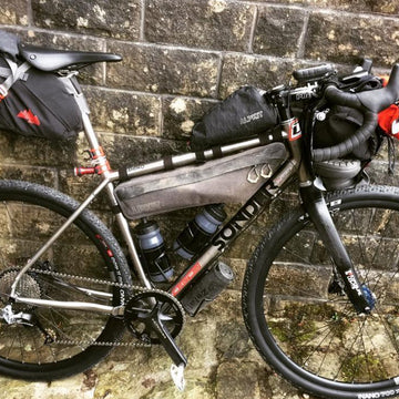
Some Spanish guys had the pace on me but as Val Veny came into view I really turned the tables on them. It was time to unleash my 600m of potential energy, I was driven on, legs pounding, up, down, up, down, swooshing and hooting. Small rocks scattering under my wheels, pinging against my steel frame, but I didn’t care, I was rolling again. Then I started to chase it down, the bike shuddering and groaning underneath me. The backend squealed one way or another but I kept it on course, kept it true.
Flattening out under the gaze of Mont Blanc the TMB shoots up right to Courmayeur. I knew this would be yet another long push so I took the easy option along the valley, my momentum only absorbed by the climb into Val Ferret which was steeper and more continuous than I remembered. Once up it was a cruise along the valley floor dodging fellow tourists. it went on, and on until finally there was no more valley floor and the track rose up to Rifugio Elena. Now, I gave this a real good effort, making the initial steep section but fading in the middle flatter section before a dose of Haribos perked me up for the final section of hairpins.

The scene was huge, so many new things seen. big toes slamming into the front of my shoes, breaks squealing at the end of their life, gotta hold it, can’t let it get away from me. Elbows and knees bent trying to absorb the hits. It was superb singletrack which took me past La Fouly, through woodland and meadows, past donkey trekkers and day trippers. Below Champex I left the TMB to follow the road rather than pushing my bike up another 500m.

The final section started quickly, nice downhill and I thought I would be at the Col de la Forclaz in an instance. Then it started to ascend gently, then steeper before rearing up into another 500m climb over rocks and trees. It was a bit like all of the worst sections of the WHW alongside Loch Lomond, but for 500m. I hadn’t seen that coming. After you have used a 1:25,000 scale map it is hard to readjust to 1:50,000.
I passed a guy on day 50 of the GTA. He was going self supported and was looking for somewhere to pitch his tent. He told me I wouldn’t be riding my bike much, I didn’t have any come back but I wished him well.
Eventually the tortuous path traversed to Bovine and I was really back in the saddle and descending steeply along the rocky path through trees in fading light, which by the time I reached the road was 100% dark and still 21km from Chamonix.
Other than being pretty inconvenient, with at least 5 lights in my van it was just plain embarrassing. I was struggling to make the most of what I had; the flashing green leds of my SPOT tracker and a mobile phone, so when I eventually arrived at Le Chatelard on the Swiss/French border (to be honest I had completely forgotten I was in Switzerland), I had to think carefully how to proceed. #1 Call a friend. but he was sleeping. #2 Try hitching. but it was now 11pm, and it wasn’t a busy road with only BMWs and Audis passing by. The only solution was #3 a second bivvy until it was light enough to continue.

Route Details
The short descriptions I had found on the internet prior to arriving were brief. None followed the TMB in its entirety, but did indicate a loop was possible in 4 days. Picking up a map for the first time in Chamonix and thumbing through the TMB trekking guide and realising it was a 11 day trek put a few doubts in my head.
My 1:50000 scale map gave little idea of the terrain, in fact the fat purple line of the TMB obliterated any indication of tarmac road, track or path. I would experience joy when the unrideable singletrack ascent I was expecting turned out to be road and pain when it was the opposite. Check out MapmyRide for my TMB route.
Distance: 142km
Height gain: 5750m
Total riding time: 29hrs
Day 1: Les Tines to Les Chapieux via Les Houches, Col de Vosa, Les Contamines and Col du Bonhomme
Day 2: Les Chapieux to Le Chatelard via Col de la Seigne, Grand Col Ferret and Col de la Forclaz
Day 3: Le Chatelard to Chamonix via Col de Montets
A couple of weeks after my ride the Ultra Trail Mont Blanc (UTMB) took place and was won by Killian Jornet in 20 hrs 36 minutes. He didn’t have a bike. Check out this video for an idea of the route.

